UFC 3-210-10
25 October 2004
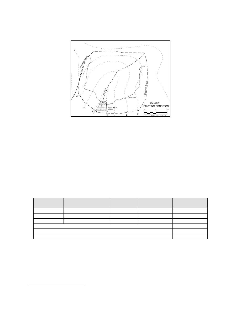
Figure 10-5. Map of Existing Conditions
10-2.2
Post Development Curve Number Calculations. The conventional method
for assigning a curve number to a residential development is to choose a single curve
picture of the proposed housing type, which can be classified as "Townhouse
Residential District". For this land use, the CN from Table 2-2a of TR-55 is 85.
The LID method allows for the calculation of a "customized" CN that reflects
the actual field conditions rather than a broad estimation. For this example, the
amounts of impervious cover and other land covers were calculated directly from Figure
10-7. Table 10-3 is a summary of the proposed condition's "customized" CN using the
LID calculation method.
Table 10-3. Composite Curve Number Calculation for Proposed Condition
Hydrologic
CN (Table
Area
Product of CN
Cover Description
Soils Group
2-2 TR-55)
(Acres)
x Area
B
Lawn (fair condition)
69
3.2
220.8
B
Woods, Fair
60
0.7
42.0
B
Impervious
98
2.6
254.8
Sum of Products
517.6
Drainage Area
6.5
Weighted CN
80
41
Ibid.
68


 Previous Page
