TM 5-815-5/AFM 88-5, Chap 6/NAVFAC P-418
characteristics and stratification of the soil and rock
(a) Completely penetrate and sample all
aquifers that may have a bearing on dewatering an ex-
formations in the area. With this information and the
size of and depth of the excavation to be dewatered,
cavation and controlling artesian pressures.
the remainder of the geologic and soil investigations
(b) Identify (and sample) all soils or rocks that
can be planned. Seismic or resistivity surveys (as well
would affect or be affected by seepage or hydrostatic
pressure.
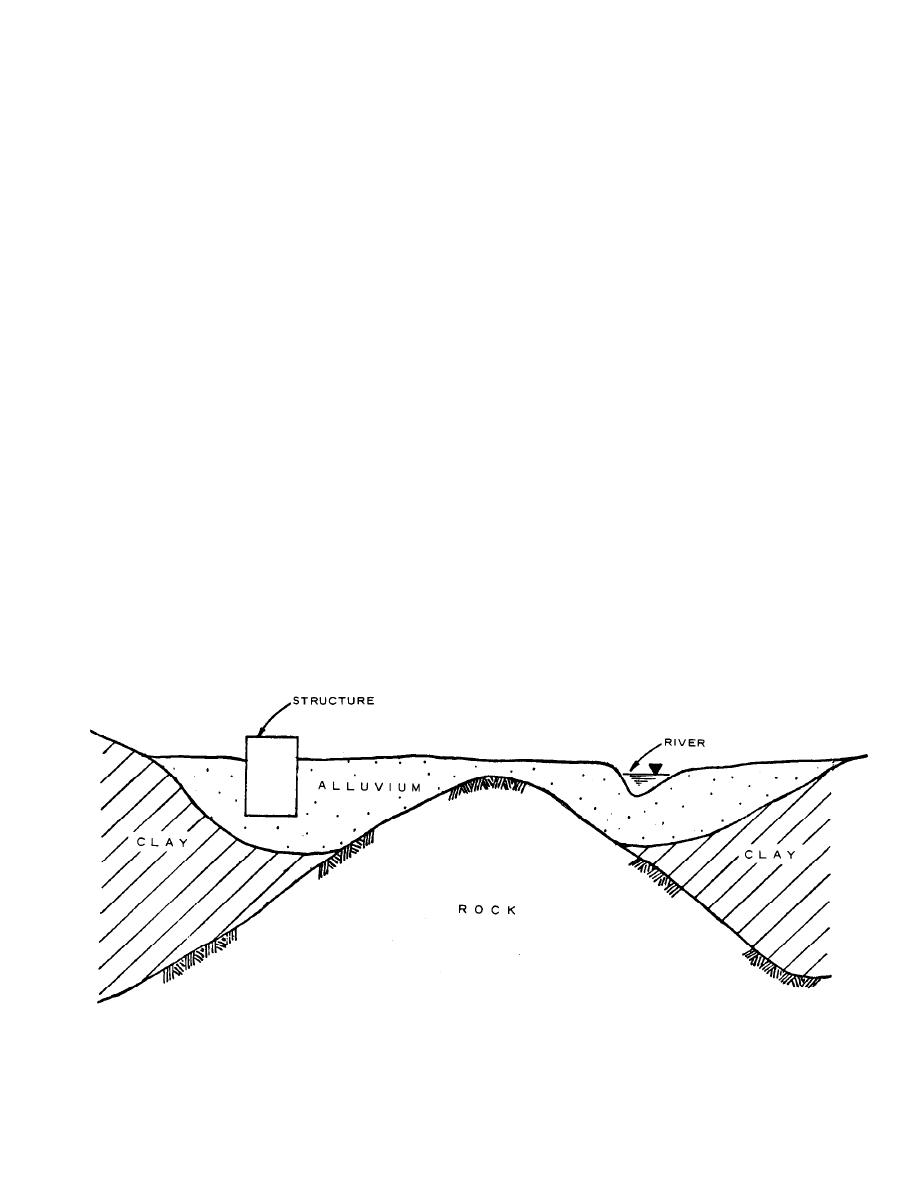
as logged core and soil borings) may be useful in deline-
(c) Delineate the soil stratification.
ating the thickness and boundaries of major geologic
(d) Reveal any significant variation in soil and
and soil formations and will often show irregularities
rock conditions that would have a bearing on seepage
in the geologic profile that might otherwise go unde-
tected (fig. 3-1).
flow, location and depth of wells, or depth of cutoff.
Continuous wash or auger boring samples are not con-
a. Borings.
sidered satisfactory for dewatering exploration as the
(1) A thorough knowledge of the extent, thick-
fines tend to be washed out, thereby changing the
ness, stratification, and seepage characteristics of the
character of the soil.
subsurface soil or rock adjacent to and beneath an ex-
cavation is required to analyze and design a dewater-
b. Rock coring. Rock samples, to be meaningful for
ing system. These factors are generally determined
groundwater studies, should be intact samples ob-
tained by core drilling. Although identification of
during the normal field exploration that is required for
rocks can be made from drill cuttings, the determina-
most structures. Samples of the soil or rock formation
obtained from these borings should be suitable for
tion of characteristics of rock formations, such as fre-
classifying and testing for grain size and permeability,
quency, orientation, and width of joints or fractures,
if the complexity of the project warrants. All of the in-
that affect groundwater flow requires core samples.
formation gathered in the investigation should be pre-
The percent of core recovery and any voids or loss of
sented on soil or geologic profiles of the site. For large,
drill water encountered while core drilling should be
complex dewatering or drainage projects, it may be de-
recorded. The approximate permeability of rock strata
can be measured by making pressure or pumping tests
sirable to construct a three-dimensional model of col-
of the various strata encountered. Without pressure or
ored pegs or transparent plastic to depict the different
pumping tests, important details of a rock formation
geologic or soil formations at the site.
can remain undetected, even with extensive boring
(2) The depth and spacing of borings (and sam-
ples) depend on the character of the materials and on
and sampling. For instance, open channels or joints in
the type and configuration of the formations or depos-
a rock formation can have a significant influence on
its as discussed in TM 5-818-1/AFM 88-3, Chapter 7.
the permeability of the formation, yet core samples
Care must be taken that the borings accomplish the
may not clearly indicate these features where the core
following:
recovery is less than 100 percent.
U.S. Army Corps of Engineers
Figure 3-1. Geologic profile developed from geophysical explorations.
3-2


 Previous Page
