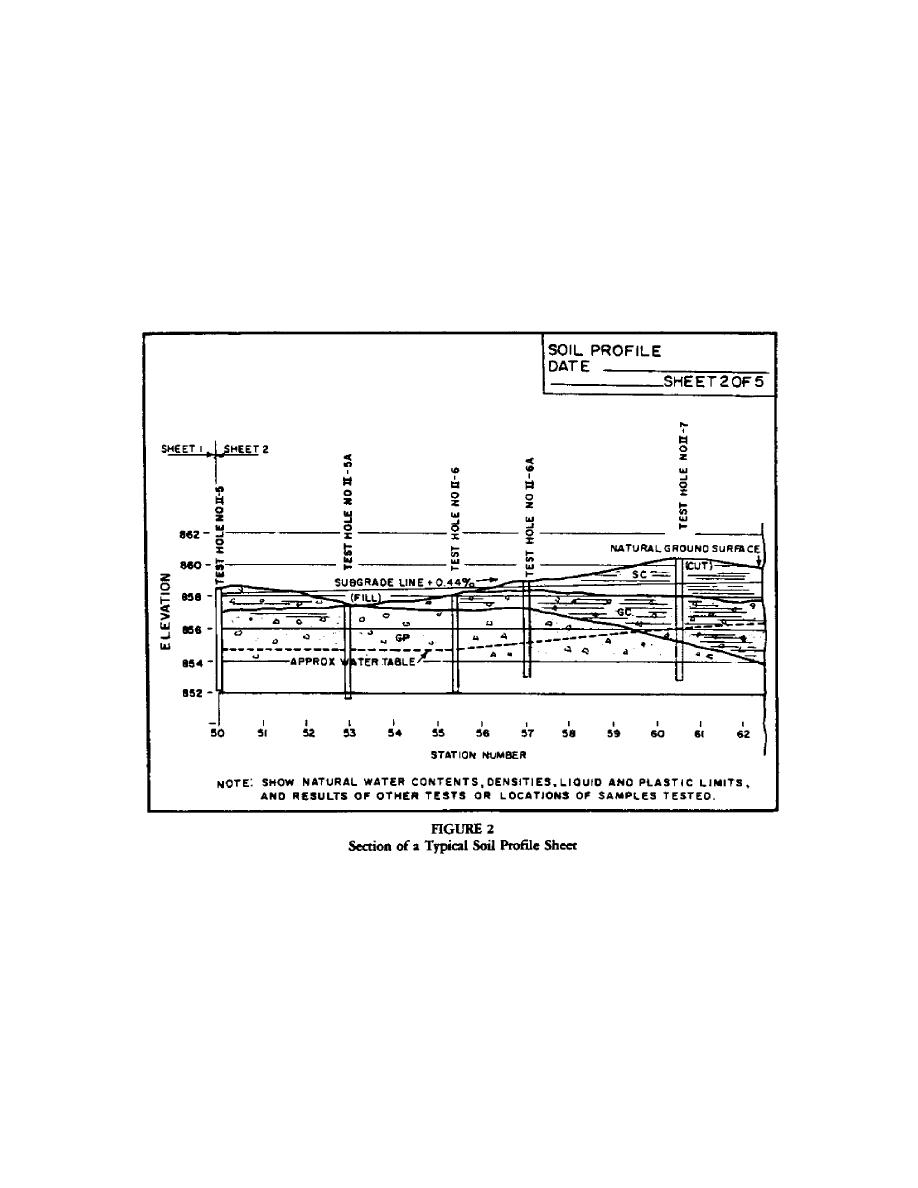
4. SOIL PROFILES. Plot soil profiles from the data obtained in the exploration
program. A typical soil profile is shown as Figure 2. The soil profile should
indicate the soil classification, moisture contents, blow counts (where
applicable), Atterburg Limits, in-place density, and ground water levels.
Examine the completed profiles to determine:
a.
Location of grade lines.
b.
Existence of unsuitable soils which may require excavation.
c.
Soils in cut which are suitable as fill.
d.
Location of ground water levels and potential compaction and drainage
problems.
5. TEST PITS. Supplement the borings with test pits in the predominate surface
soils. Use test pits for conducting in-place strength and density tests on
potential subgrade materials. Observe and log the thickness of the strata and
obtain bag samples for laboratory tests.
6. SUBGRADE TESTING. See Table 3 for American Society for Testing and
Materials
(ASTM), American Association of State Highway and Transportation Officials
(AASHTO), and MIL-STL test methods
4


 Previous Page
